1 Background
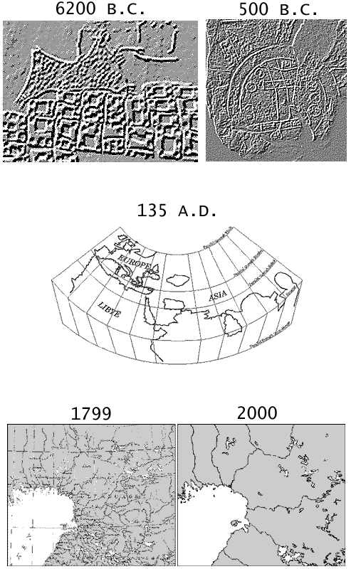
Man has always had a need for knowing where things are, what they are, when they occur and, sometimes, why they are. Basically, this is all what maps are about, i.e. our main vehicle for representing knowledge that relates to temporal and spatial phenomena. Primitive maps are generally considered to pre-date all other forms of written communication. The oldest artifact considered to be a map is a Turkish wall engraving dated to approximately 6200 BC depicting the ancient Catal Hyuk village [HDC1]. The first map to encompass the whole (known) world is a clay tablet made around 500 B.C., showing Babylonia in the center surrounded by seven islands, that is, outer and mostly unknown parts of the world [HDC2].
In the end of the 13th century, a Byzantine monk found a manuscript copy of Geographia by the Alexandrian astronomer and mathematician Claudius Ptolemy (approx 135 A.D.) [THAY]. During the Dark Ages, this important work on geography was considered lost. In eight volumes, Ptolemy explains how to make maps and lists 8000 inhabited localities including their latitude and longitude. He also presents a world map, 24 regional maps and 67 detailed map sheets from selected areas. Geographia remained the most important source for geographic information for over 1500 years. In 1750, more than 50 different editions of Ptolemy's work had been published. Two millennia later, we still use the same basic methods and principles for modeling our physical surroundings.
We assume the reader has some basic knowledge of the core concepts of digital modeling of geographic information. For a quick introduction to the topic, see e.g. [USGS].